Virtual Design Construction

Our Experts

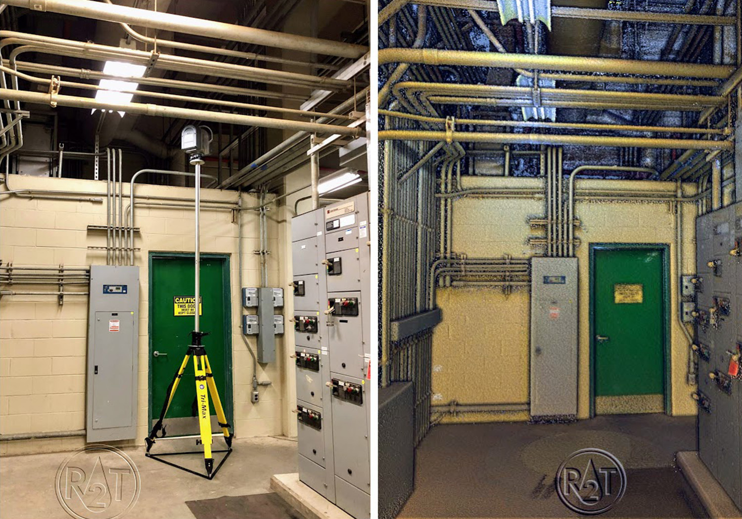
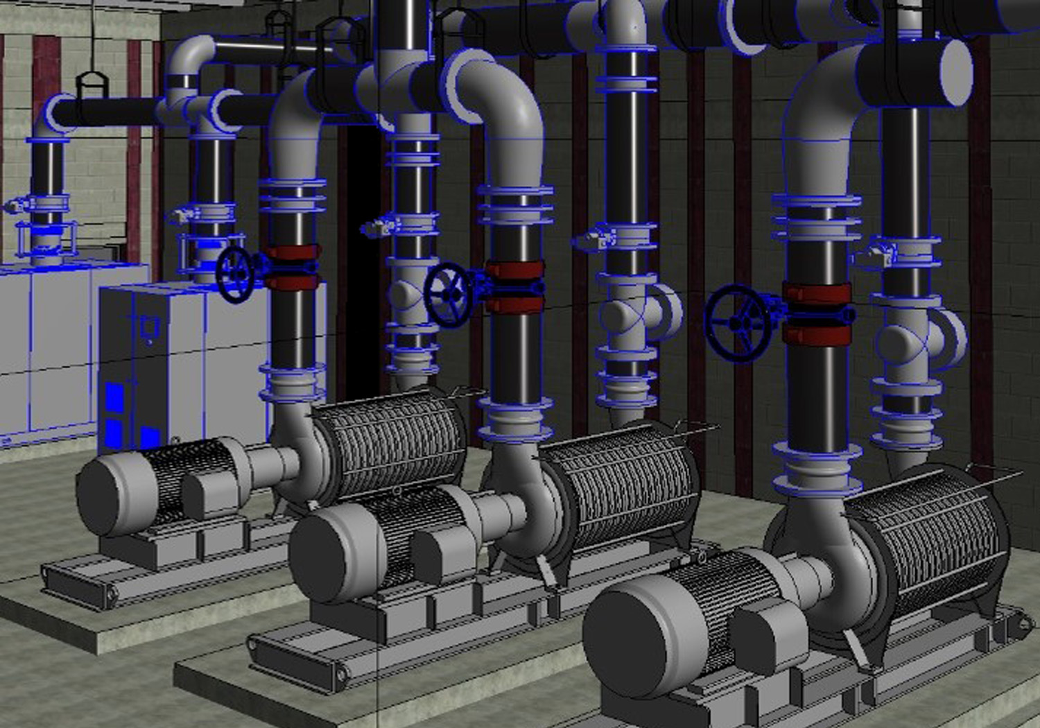
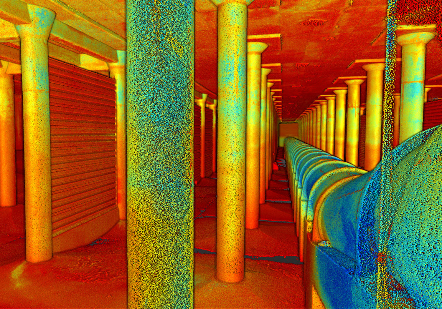
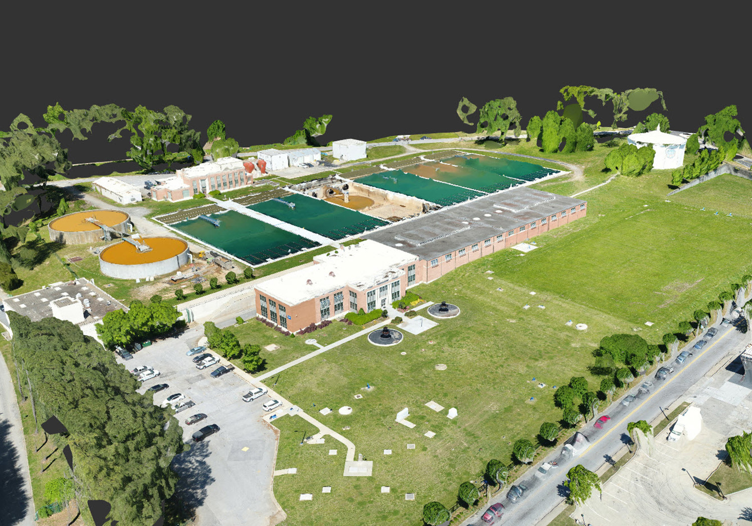
Virtual Design Construction (VDC) is an innovative way to approach infrastructure projects. R2T has the capability to utilize integrated building information modeling (BIM) throughout the entire life cycle of a project, developing and tracking actual progress against expected results. The digital assets developed during the planning, design, and construction of the project can then be carried into operations ensuring the infrastructure assets are performing efficiently and effectively. R2T has the in-house capacity to utilize VDC at various phases of your project.

Projects

F. Wayne Hill WRC Laser Scanning

R2T provided complete scan and point cloud development for four electric rooms at the F. Wayne Hill WRC. The effort was required to verify existing conditions to allow the additional replacement of electric and I&C wiring and conduit. Major roles included: Complete laser scan of the impacted facility, development of a point cloud and existing model in REVIT, used Constructable Contract/Trimble SysQUE in REVIT environment to construct proposed improvements, and generated models.

Aspinwall Pump Station

The VDC team utilized a laser scan point cloud and record drawings to develop an as-built 3D Building Information Model (BIM) of the interior and exterior of the Aspinwall pump station to capture existing mechanical, electrical, plumbing, and structural features of the facility. R2T developed a BIM Implementation Plan using Revit software broken into individual discipline models.

PGA WWTP Blower Building & Pump Station Upgrades

R2T’s VDC team utilized a state-of-the-art laser scanner, Trimble TX8, to scan the existing conditions of facilities and grounds at each area to create a computer-generated point cloud. The point cloud for each project is a virtual design model that was assembled from more than 25 individual scans of each area of the plant. The VDC team used industry-leading Revit by Autodesk as the Building Information Modeling (BIM) application and Civil 3D application. These tools were used to develop 3D models of the existing facilities, piping, and grading. The tools enabled the VDC team to integrate the physical components of the various disciplines into a seamless environment to help coordinate, identify clashes, and reduce and eliminate field conflicts. Our VDC team offered the Owner the tools to increase productivity on site, decrease construction time, reduce construction cost, and visualize constructability.

Lardner Pump Station Scanning & Modeling

R2T provided high-definition laser scanning and the preparation of a Building Information Model (BIM) of the Lardner's Pump Station interior to capture existing mechanical, electrical, plumbing, and structural features of the facility. Modeling was performed using Autodesk Revit 2020 software.

Bolton Road and Phillip Lee Pump Stations

R2T’s VDC team supplemented and enhanced the evaluation and design of the Bolton Road and Phillip Lee Pump Stations projects. Over a period of one day, the VDC team collected information from over 106 scan stations and more than 100 images in and around the pump stations. Once collected, the VDC team began registering the scans using Trimble RealWorks. Within 20 days, the team scanned the sites and generated the models in Revit. The team was responsive and saved incalculable time and effort for the engineers from having to field measure conditions with multiple site visits. As the designers for the Bolton Road and Phillip Lee Pump Stations project, R2T developed intelligent digital 3D models using Revit and Civil 3D by Autodesk as its BIM technology to plan, design, and collaborate across multiple disciplines.

Dalecarlia Water Treatment Plant Improvements

R2T’s VDC team was a key aspect of the project in meeting the requirements, design needs, and schedule of the Dalecarlia WTP Clearwells Maintenance and Improvements project. The project deliverables included as-built 3D models and an asset registry of the two clearwells, which was achieved through laser scanning and data organization and the input of existing equipment specifications. The capability of the scanner enabled the VDC team to work in various lighting conditions from full daylight on the exterior to dim light conditions on the interior including areas of complete darkness. From this scanning effort, R2T was able to generate comprehensive digital 3D point cloud models from over 400 individual laser scans.

Chattahoochee & Hemphill WTP Compliance Improvements

The projects implemented in-house VDC technologies to assist with the 3D design and discipline coordination. The team documented significant portions of the expansive sites and large facilities. Because the plants were in continuous operation, the team offered flexibility in the data collection effort, collecting over 20 gigabytes of digital data through point cloud images and photography of the sites. The VDC team was responsive and saved valuable time and effort for the engineers such as having to field-measure existing conditions with multiple site visits. R2T utilized advanced technology to develop 3D models of existing and new facilities to enhance the design and coordination of the complexity of the projects.

Areas of Expertise

BIM-VDC

The emergence of Building Information Modeling (BIM) and related technologies are transforming the design and construction industry and continues to reshape how we deliver projects today. BIM helps define dimensions and spatial relationships, avoid interference, assure clearance, develop material takeoffs, etc.

BIM-VDC:

  • Structural 3D Modeling and Design
  • Civil Infrastructure 3D Modeling and Design
  • Process Mechanical 3D Modeling and Design
  • Point Cloud to BIM
  • 3D As-Built Modeling & Documentation
  • 3D Modeling from 2D Drawings
  • COBie Database Creation

Laser Scanning

Laser scanning is a highly accurate method to capture the details of an existing building or construction site by using laser light (LiDAR). Advanced scanners create 3D representations known as point clouds.

Laser Scanning Benefits & Applications:

  • High Precision As-Built of Existing Conditions
  • Fewer Physical Site Visits
  • Decreased Field Time
  • Increased Visibility and Understanding
  • Reduced Rework
  • Validation of BIM Design Model
  • Enhance Coordination of Systems and Utilities
  • Measure Difficult-to-reach Areas Safely
  • Quality Control During Construction

UAV Mapping

Digital Deliverable

  • Point Clouds
  • Digital Surface Models
  • Orthomosaic Imagery
  • Volume Determinations
  • Custom Derived Data Products

UAV Mapping Application

  • Quarries & Mining Operations
  • Landfill Management
  • Construction
  • Aggregates
  • Natural Resources
  • Transportation
  • Linear work
  • Environmental, industrial & utility

3D Spatial Coordination

3D spatial coordination is a collaborative process where we combine fabrication-level models from different trades such as Mechanical, Electrical, Fire protection, and plumbing into a 3D environment. This allows project teams to identify conflicts in three-dimensional space. This process reduces construction costs and time, but also increases productivity and eliminates rework. Additionally, the owner will have the ability to visualize the mechanical systems before they are built.


The Associated General Contractors of America

We are proud to hold the AGC Management-Building Information Modeling (CM-BIM) Certificate. An assessment-based credential that denotes knowledge and understanding of concepts related to BIM adoption, practice, and process transformation.